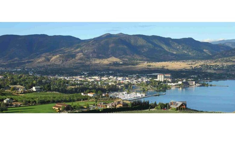
Land surveying is a crucial aspect of property development and management. It involves accurately determining the terrestrial or three-dimensional positions of points and the distances and angles between them. In Osoyoos, a picturesque town in British Columbia known for its unique geography and climate, land surveying is especially important due to the varied topography and diverse land uses. This blog will guide you through the step-by-step process of conducting a land survey in Osoyoos, ensuring you understand each phase and its significance.
Step 1: Initial Research and Preparation
Define the Purpose
The first step is to clearly define the purpose of the land survey. This can range from establishing boundary lines to preparing for construction or resolving a legal dispute. Knowing the exact purpose will guide the entire surveying process.
Gather Documents
Next, gather all relevant documents, including previous surveys, property deeds, and maps. These documents provide historical data that is crucial for an accurate survey. In Osoyoos, local government offices and registries can be valuable resources for obtaining these documents.
Hire a Professional Surveyor
Hiring a licensed and experienced land surveyor is essential. Look for professionals with a good reputation and familiarity with the Osoyoos area. They should be well-versed in local regulations and geographical nuances.
Step 2: Conducting the Field Survey
Site Visit and Reconnaissance
The surveyor will visit the site to get an initial understanding of the terrain and any visible landmarks. This reconnaissance helps in planning the actual survey work. In Osoyoos, this might involve navigating through vineyards, orchards, residential areas, and waterfront properties.
Establishing Control Points
Control points are fixed points of known coordinates used as references for the survey. These points are established using high-precision GPS equipment or traditional methods like triangulation. Accurate control points are crucial for ensuring the survey’s overall accuracy.
Data Collection
The surveyor will then use various tools and technologies, such as total stations, GPS devices, and drones, to collect data. This data includes measurements of angles, distances, and elevations. In a diverse landscape like Osoyoos, this step can be complex and may require extensive data collection to account for the varied terrain.
Step 3: Data Analysis and Mapping
Data Processing
Once the field data is collected, it is processed using specialized software. The surveyor will analyze the data to ensure its accuracy and completeness. This step involves correcting any errors and ensuring the data aligns with the control points established earlier.
Creating the Survey Map
The processed data is then used to create a detailed survey map. This map will include all relevant information such as boundary lines, topographical features, and any structures on the property. The map should be clear and precise, serving as a valuable tool for the property owner and any involved parties.
Review and Certification
The surveyor will review the final map and certify its accuracy. This certification is important for legal and official purposes. It ensures that the survey adheres to all relevant standards and regulations.
Step 4: Reporting and Application
Survey Report
A comprehensive survey report is prepared, detailing the findings and providing insights into any potential issues or considerations. This report is often accompanied by the survey map and any relevant documentation.
Application of Survey Results
Finally, the survey results are applied to the intended purpose. For example, in a property transaction, the survey map and report might be used to finalize the sale. In construction, they provide the necessary data for planning and building. In legal disputes, they serve as evidence to resolve boundary issues.
Core Geomatics: Your Partner in Land Surveying
Core Geomatics offers expert land surveying services tailored to the unique needs of Osoyoos. With a team of experienced professionals and advanced technology, Core Geomatics ensures accurate, reliable, and efficient surveys. Whether you’re developing land, resolving disputes, or purchasing property, Core Geomatics is your trusted partner in navigating the complexities of land surveying.
Conducting a land survey in Osoyoos involves meticulous planning, precise data collection, and thorough analysis. By following these steps and working with experienced professionals like Core Geomatics, you can ensure your survey is accurate and serves your needs effectively.
For more information about Land Survey Services Regina and Real Property Reports Saskatoon please visit:- CORE Geomatics